Skip to content

Urban planning
in Wellesley, MA

Site and district plans that balance growth, access and sustainability. Our team serves Wellesley and nearby Needham and Natick.

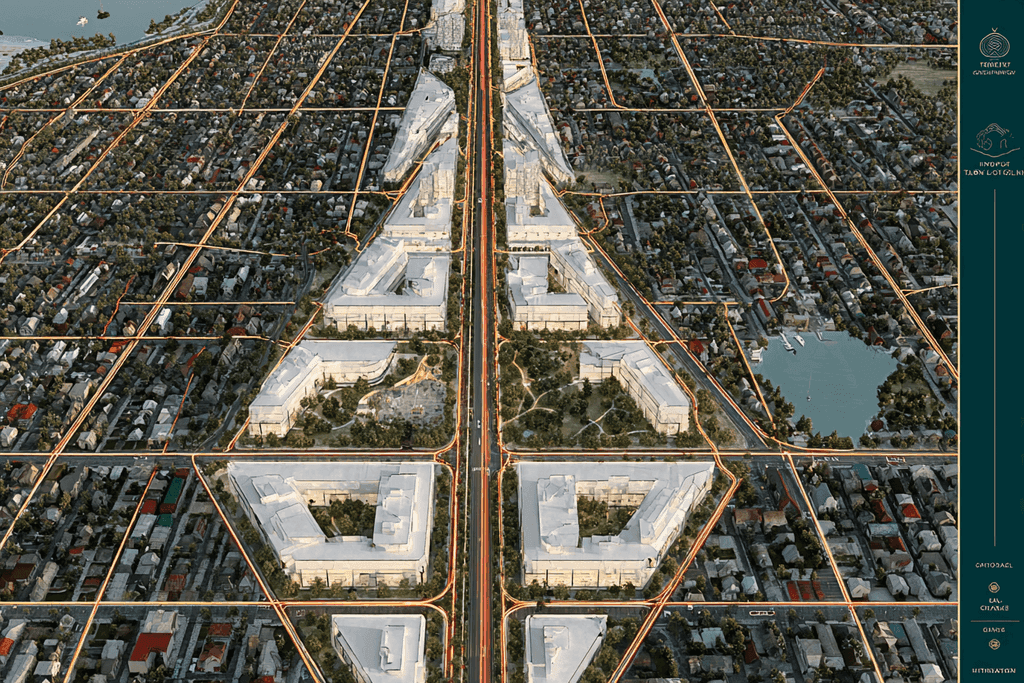
Aerial view of a planned urban district with green corridors — urban planning in Wellesley, MA
  • 30,347Residents of Wellesley
  • 9,400Housing units in Wellesley
  • 15%Homes in multi-unit buildings
  • 2Local ZIP codes
About our Wellesley work

Urban planning for Wellesley projects

HUNT provides urban planning for homeowners, developers and businesses in Wellesley, MA. Site and district plans that balance growth, access and sustainability.

Wellesley has about 9,400 housing units: 82% are single-family detached houses and 15% are in buildings with two or more units. In a predominantly single-family town, new development is typically measured against the scale and character of existing neighborhoods.

We serve ZIP codes 02481 and 02482 and every community within 25 km of Wellesley. Wellesley is about 6 miles from our Framingham dispatch hub, well inside the 60-mile radius our superintendents and equipment cover. Nearby towns where we also provide urban planning include Needham, Natick and Dover.

Local considerations

Building in Wellesley: What's Local

What the public record says about building in Wellesley — and what it means for urban planning.

  • Homes in Wellesley

    Wellesley has about 9,400 housing units: 82% are single-family detached houses and 15% are in buildings with two or more units. In a predominantly single-family town, new development is typically measured against the scale and character of existing neighborhoods.

    Source: U.S. Census Bureau, American Community Survey 2020–2024 5-year estimates (opens in a new tab)
  • Historic districts

    Wellesley has one or more local historic districts. Exterior changes to buildings inside a district, particularly those visible from a public way, may need approval from the historic district commission before work begins. Plans that touch a district need to account for that review in their timeline and design.

    Source: wellesleyma.gov (opens in a new tab)
  • Wetlands & conservation

    Work in or near wetlands, streams, ponds and their buffer zones is regulated under the Massachusetts Wetlands Protection Act, and filings are made with Wellesley's Conservation Commission. Mapping resource areas early shows where a site can and cannot be developed.

    Source: wellesleyma.gov (opens in a new tab)
  • Sewer & septic

    Municipal sewer discharging to the MWRA system (Deer Island Treatment Plant). Connections to the municipal sewer and water systems are coordinated with the town as part of the site plan.

    Source: mwra.com (opens in a new tab)

Good to know about urban planning

  • EPA explains that transit-oriented development combines compact development within easy walking distance of a transit station with a mix of land uses, making it more convenient to walk, bicycle or take transit.

    Source: epa.gov (opens in a new tab)
  • EPA notes that large surface parking lots and standalone garages can discourage walking and can make driving the only viable way to travel between destinations.

    Source: epa.gov (opens in a new tab)
  • Research reviewed by EPA found daytime temperatures in urban areas about 1–7°F higher than in outlying areas and nighttime temperatures about 2–5°F higher, an effect known as the urban heat island.

    Source: epa.gov (opens in a new tab)
About the service

How we deliver urban planning

Planning communities that work for decades

Successful development starts long before ground is broken. Our planning team studies the site, the zoning and the surrounding community to shape a plan that is approvable, buildable and built to last.

“Good planning is invisible — it simply makes everything else easier.”

We coordinate roads, utilities, open space and building placement into a phased master plan, so each stage of construction supports the next.

Why HUNT for urban planning?

Because we also build what we plan, our phasing and logistics strategies are grounded in real construction sequencing — not theory.

Who Is It For?

  • Developers assembling multi-building or mixed-use sites
  • Municipalities and public-private partnerships
  • Campuses planning long-term growth

This service handles everything:

From feasibility to a phased, permit-ready master plan.

Service Area

Regional service area & Fleet logistics

Headquartered in the central metropolitan hub with continuous 60-mile equipment and superintendent rapid response radius.

  • Highlighted primary service city
  • Nearby cities and neighborhoods
  • Dispatch location
  • Metro core corridor
FAQs

Urban planning in Wellesley: your questions

Straight answers about planning, budgets, timelines and working with our team.

Still have questions?

Our team is happy to talk through your project and get back to you within 24 hours.

Start your project

Ready to start building?

HUNT is your go-to construction partner - fast, flexible, and built to get results easily.

  • Reply within 24 hours
  • Design-build under one roof
  • 60-mile service radius